
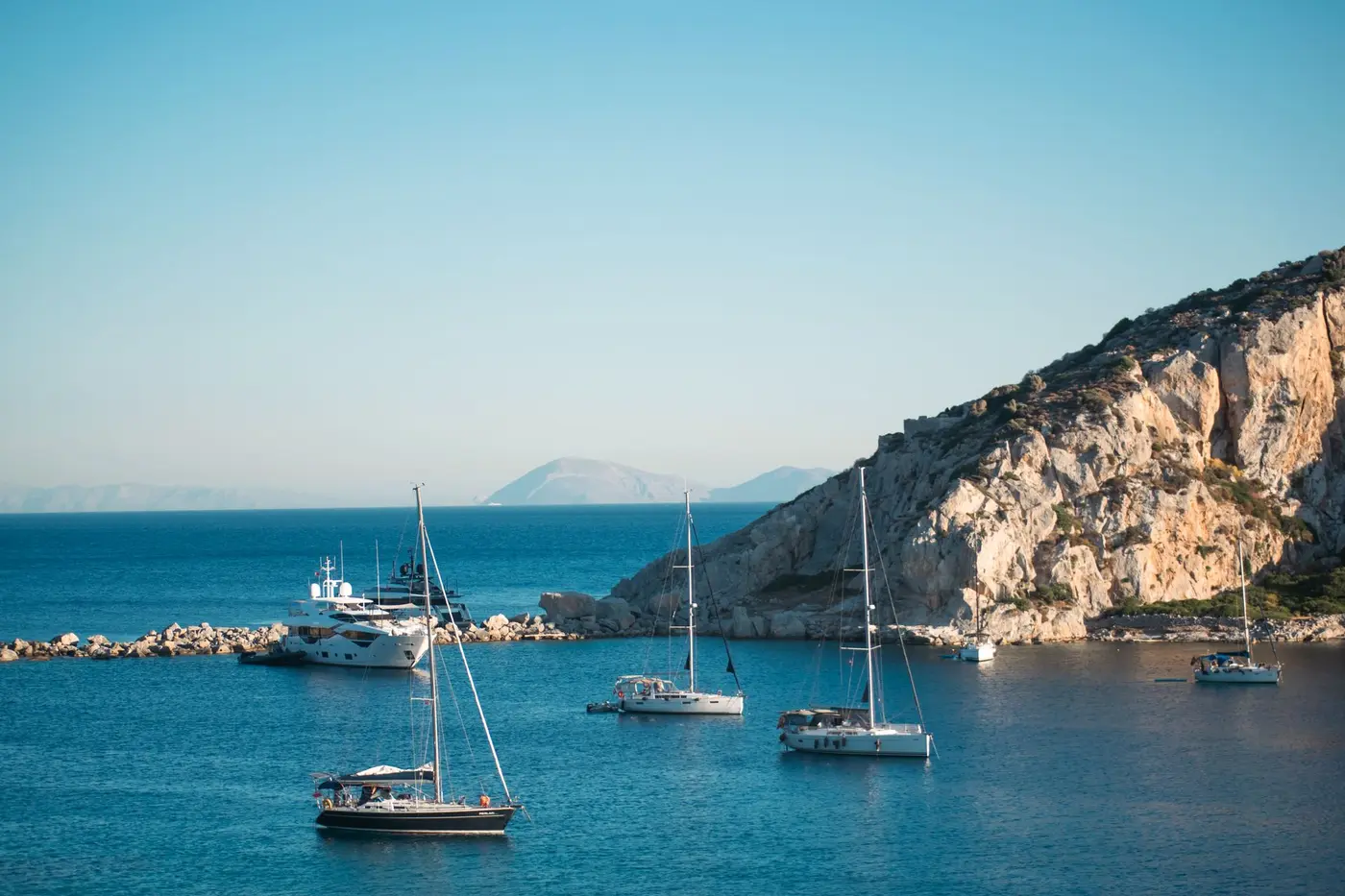
Every second email I receive from the United States asks the same question in different words: which Greek islands are the Cyclades, which of them should we see, and how far apart are they? People have a picture in their head, white houses and blue doors on a dry hill above a very blue sea, and they want to know where that picture is and how to move through it. This is the answer I give, island by island, with the nautical miles from the house distance table and the anchorages my captains actually use. It is written for someone planning a week, by yacht or otherwise, and it says plainly where the picture is not.
What are the Cyclades, and why do they look the way they do?
The Cyclades are the group of islands in the central Aegean, south-east of Athens, that the ancient Greeks saw as a circle around the sacred island of Delos: the name means exactly that. About two dozen of them are inhabited. They are dry, low on trees, tall on rock, and their villages are white because whitewash was cheap and cool. Mykonos, Santorini, Paros and Naxos are the names most people know; Sifnos, Milos, Folegandros, Amorgos and the Small Cyclades are the names people come back for.
The other thing that shapes them is wind. In July and August the Meltemi blows from the north at 15 to 30 knots on most afternoons, which is why the villages sit in the lee of hills, why the harbours face south, and why a week in the Cyclades is planned around shelter rather than around a postcard. June and September, when the wind is lighter and the water is warm, are the months I recommend without being asked; the weather guide has the pattern month by month.
Which Cyclades islands are there, and how do they group?
There is no official grouping, but every captain thinks of them in five clusters, and so do I. The Western Cyclades, closest to Athens: Kea, Kythnos, Serifos, Sifnos, Milos and Kimolos. The Northern and central islands: Andros, Tinos, Syros, Mykonos with Delos, Paros with Antiparos, and Naxos. The Small Cyclades east of Naxos: Koufonisia, Iraklia, Schinoussa and Donousa. Amorgos, alone on the eastern edge. And the Southern Cyclades: Ios, Sikinos, Folegandros, Santorini and Anafi. Each island below has its own anchorage page on this site, written from published cruising sources, and I link it so you can go deeper.
The Western Cyclades: Kea, Kythnos, Serifos, Sifnos, Milos, Kimolos
Kea, called Tzia by Greeks, is the first island out of Athens, 35 nautical miles from Alimos, and its harbour at Vourkari, inside Agios Nikolaos bay, is one of the safest natural harbours in the Mediterranean; it is deep, so the crew lay at least 40 metres of chain. It is the natural first night of a Cyclades week from Athens. The Kea anchorages page has the three bays.
Kythnos, 15 miles on, is quieter than its neighbours and has one of the Cyclades' best swims at Kolona, a sandspit with sea on both sides, three to ten metres over weed where the anchor goes on a sand patch. Kanala on the south-east holds well in eight to fifteen metres of sand, and Agios Stefanos on the east coast has the best holding on the island, over mud. See the Kythnos anchorages.
Serifos is steep and quiet, with a chora high on the rock. Koutala on the south coast, five to fifteen metres over sand, gives good Meltemi shelter but violent katabatic gusts, and Megalo Livadi on the west coast is very secure. The Serifos anchorages explain which cove for which wind.
Sifnos is the island my clients name most often on a second visit, and the reason is the food: chickpea soup baked overnight, lamb, local cheese, a tradition of chefs. Vathy on the south-west coast, three to four metres over sand, is the safest harbour on the island with all-round shelter; Kamares, the ferry port, does not always hold, so the crew use plenty of chain. Sifnos is 80 miles from Alimos, 35 from Paros and 25 from Milos. The Sifnos page and the Sifnos anchorages cover it.
Milos is volcanic, and its coast reads like a sculpture park: the white moonscape of Sarakiniko on the north shore, the caves of Kleftiko on the south coast that are reached by tender only. Adamas Bay, the great harbour, is five to ten metres over mud and sand with good holding; Provatas on the south coast is three to six metres over sand. June and September are the months for Milos, when the south-coast caves stay accessible. Milos is 75 miles from Alimos and 70 from Santorini. The Milos page and the Milos anchorages go further.
Kimolos, across a narrow strait from Milos, is the quiet one: Prassa on the north-east coast, five to twelve metres over sand, is protected from the Meltemi, and the uninhabited islet of Polyaigos to the east has an anchorage in two to three metres of sand that most visitors never see. See the Kimolos anchorages.
The northern and central islands: Andros, Tinos, Syros, Mykonos, Paros, Antiparos, Naxos
Andros is the northernmost Cycladic island, 50 miles from Athens and closer than Mykonos, green where the others are brown, with a chora of neoclassical mansions built by shipowning families. Gavrio, the main port on the north-west coast, is four to six metres over mud; Batsi on the south-west is sand. It suits a short week from Athens. The Andros page and anchorages have the detail.
Tinos is the shortest hop from Mykonos and the opposite temperament: forty marble villages on the mountain, a pilgrimage church in the town, and a food scene that now competes with anyone. Around 15 August the town fills for the feast of the Virgin; the anchorages stay clear. Panormos bay on the north-west has sand and seaweed with good holding, Kolympithra on the east side three to six metres over sand. See the Tinos page and anchorages.
Syros is the administrative capital of the Cyclades, 70 miles from Alimos and 25 from Mykonos, and its anchorages are on the south and west: Finikas, three to six metres over sand with good holding, Vari on the south coast, and Megali Agkali by the Didymi islet with excellent holding in about six metres. The Syros anchorages page ranks them.
Mykonos is the island with the most direct international flights and the deepest concentration of beach clubs and chef-led tavernas, 90 miles from Alimos and 75 from Lavrio, and it is the natural base of a Cyclades week: a client can land at two in the afternoon and be aboard by half past four. On the house table its bays are Ornos, six to twelve metres over sand, Psarou eight to fifteen, Platis Gialos six to ten, Paranga eight to twelve, all sheltered from the north; Kalafati on the east coast is the best Meltemi shelter on the island. Delos, the sacred island of the ancient circle, is a morning by tender. The Mykonos page and the Mykonos anchorages are the two I send most.
Paros has quietly become the most balanced base in the Cyclades, close enough to Mykonos for the social calendar and far enough to keep its character. Naoussa, eight to fifteen metres over sand, is the prettiest anchorage in the Cyclades and open to the Meltemi, so on a windy night the yacht lies in Plastira Bay outside and the tender goes in; Parikia on the west side is Meltemi-protected. Mykonos to Paros is 30 miles, Paros to Naxos 12, Paros to Santorini 60. The Paros page and the Paros anchorages have the bays.
Antiparos is the small island west of Paros, five miles away on the house table, and the discreet choice for people who want the Cycladic light without the Mykonos scene. Soros on its south coast, six to twelve metres over sand and sheltered from every direction, is arguably the clearest water in the Cyclades; the Despotiko channel beyond it, four to nine metres over sand with excellent holding, is the lunch of every Paros-based week, with the archaeological site on the islet a walk from the beach. See the Antiparos page and anchorages.
Naxos is the largest and greenest of the Cyclades, the most agricultural and the most lived-in, with the best beaches in the group along its west coast at Agios Prokopios and Agia Anna, and mountain villages that do not perform for anyone. Chora harbour, four to seven metres, gives Meltemi shelter in its north-east corner; Kalando on the south-east coast is three to six metres over sand. The Kouros at Apollonas, in the north, is a day trip by car. The Naxos page and the Naxos anchorages go on.
The Small Cyclades and Amorgos
East of Naxos lie the Small Cyclades: Koufonisia, Iraklia, Schinoussa and Donousa. Koufonisia is the one people know, for its sand and its water; the marina at Ano Koufonisi is five to six metres on laid moorings stern-to the east pier, built for all-round shelter, and Pori on the north-east coast and Fanos on the south-east are the swims. The Koufonisia anchorages, the Iraklia anchorages, and the Donousa anchorages cover three of the four; Schinoussa, between Iraklia and Koufonisia, is the fourth.
Amorgos stands alone on the eastern edge of the group, long and mountainous. Katapola, the main port on the west coast, is three to five metres over sand with some rock and weed and good holding; Aegiali at the north end is the second port, about six metres over mud and weed; Kalotaritissa at the south-west tip is three to five metres over sand and weed. The Amorgos anchorages page has the four.
The Southern Cyclades: Ios, Sikinos, Folegandros, Santorini, Anafi
Ios sits exactly midway between Mykonos and Santorini, 30 miles from each, which makes it the natural overnight of the great Aegean run south. Manganari on the south coast, four to ten metres over sand, is the swim; Tris Klisies on the south-east is three small bays; the port at Yialos lies on laid moorings in the east basin with excellent shelter. The Ios page and the Ios anchorages go further.
Sikinos is the quiet island between Ios and Folegandros. Alopronia, its only port on the south-east coast, is seven to ten metres over sand with some Posidonia, good holding in the right spot. See the Sikinos anchorages.
Folegandros is the island my clients ask for once they have done Santorini: the chora sits on a 200 metre cliff above the sea, fortified since the Venetians, reached by a switchback road from the port. That port, Karavostasi, has sand and rock that does not always hold and is not safe in a strong Meltemi, so the crew go stern-to the quay or anchor at Agali on the south coast, four to five metres over sand and weed. Folegandros is 30 miles from Santorini and 45 from Sifnos, and it is always a stop, never a boarding point. The Folegandros page and anchorages explain.
Santorini is the only Greek island that justifies a charter to itself, because the caldera can only be seen properly from the water. It is also the one place in the Cyclades where a yacht cannot anchor for the night below the view: the caldera is 80 to 180 metres deep at Ammoudi, so the sunset night is a mooring buoy secured before the charter. Vlychada Marina on the south coast, five to eight metres for yachts up to 60 metres, is the boarding point; Akrotiri, six to fifteen metres over sand, and White Beach, eight to fourteen, are the anchorages. Santorini is 130 miles from Alimos, 80 from Mykonos, 25 from Ios and 70 from Milos. The Santorini page and the Santorini anchorages have the whole strategy.
Anafi, east of Santorini, is the end of the Cyclades: two anchorages on an exposed southern coast, taken only on a settled forecast with Santorini as the fallback. The Anafi anchorages say so plainly.
How far apart are the Cyclades islands?
The distances below are nautical miles from the house table, the one my captains plan on. From Athens (Alimos): Kea 35, Kythnos 45, Syros 70, Milos 75, Sifnos 80, Mykonos 90, Paros 95, Naxos 100, Ios 115, Santorini 130. Between islands: Kea to Kythnos 15, Kythnos to Syros 25, Syros to Mykonos 25, Mykonos to Paros 30, Paros to Antiparos 5, Paros to Naxos 12, Naxos to Ios 30, Ios to Santorini 25, Santorini to Folegandros 30, Folegandros to Sifnos 45, Sifnos to Milos 25, Paros to Sifnos 35, Mykonos to Santorini 80.
What that means in a day: a motor yacht at 24 knots covers Mykonos to Paros in about 75 minutes, a sailing catamaran takes the morning. A week from Athens that respects the wind reads Kea, Kythnos, Syros, Mykonos, Paros, Sifnos and home, 245 miles in all, with the long leg saved for the last morning. The distance calculator works any pair, and Mykonos to Santorini by yacht explains why direction matters on the longest leg.
What is the Meltemi, and which islands shelter from it?
The Meltemi is the dry north wind of the Aegean summer, strongest in July and August at 15 to 30 knots, usually rising late morning and easing at night. It does not stop a Cyclades week; it decides it. The rule is simple: sleep on the south side of an island, cross in the morning, and know which harbours are safe when it blows. Vathy on Sifnos has all-round shelter. Parikia on Paros is protected where Naoussa is open. Ios port lies on laid moorings with excellent shelter. Kalafati is the Meltemi bay of Mykonos. Karavostasi on Folegandros is not safe in a strong blow, and Koutala on Serifos shelters you from the sea while the gusts come down the hill. A good captain reads the forecast at breakfast and moves the plan a day at a time; the seasickness and safety piece is where I explain the Meltemi to nervous clients.
Which Cyclades islands are best for a first visit?
Mykonos, Paros, Antiparos and Naxos, in that order of fame and in reverse order of my affection. They sit within 30 miles of one another, they give you the picture you came for, and they hold a yacht in every wind. Add Sifnos and Milos if you have the week and the appetite, and Santorini as a final night by mooring buoy if the caldera is the reason you came. The 7 day Cyclades itinerary threads a realistic week, and Athens to Mykonos by motor yacht covers the positioning leg.
Which Cyclades islands are the quietest?
Sifnos, Serifos, Kimolos, Folegandros, Sikinos and the Small Cyclades, in July and August as in June. None of them has a cruise-ship port, and their anchorages are small enough that a yacht is the only sensible way to see two of them in a day. I wrote them up in the Cyclades beyond Mykonos and Santorini, and the best Greek islands for a crewed week in 2027 puts them next to the Ionian and the Saronic.
Ferry, hotel, or yacht: how do you actually see the Cyclades?
Honestly: by ferry and hotel if you want two or three islands and a base; by yacht if you want the bays. The islands are close, but the ferry takes you from port to port, and the ports are the busiest places on every island. A yacht's day is a bay the ferry never enters, Soros, Kolona, Kleftiko, Despotiko, and its night is the harbour of your choice. The week is one price per yacht per week, never by the head, with a captain, a chef and a crew who know which bay is right this afternoon. I described that week from the deck in what a private yacht cruise in Greece is really like.
What does a Cyclades week by yacht cost?
From the Greek Charter Index, net base per yacht per week: a 15 metre sailing catamaran with five cabins for ten from EUR 17,000; a 20 to 22 metre catamaran EUR 31,500 to 43,500; a 22 to 25 metre motor yacht EUR 21,000 to 47,500; a 35 to 40 metre EUR 59,900 to 150,000. All-in, with the provisioning fund, Greek VAT at the yacht's own rate and the crew gratuity, plan on roughly 1.35 to 1.6 times the base on a catamaran and 1.45 to 1.7 on a motor yacht. The Cyclades carry the deepest demand and the Meltemi, so the yachts that end up there are the larger and faster ones, and their base rates sit higher. The crewed catamaran page for the Cyclades and the superyacht page for the Cyclades carry the cards.
When are the Cyclades the wrong choice?
If the person you love most is frightened of a moving floor, choose the Ionian: it has an afternoon breeze instead of the Meltemi and passages of 10 to 35 miles. If you have three nights, the Saronic from Athens is the honest answer, because the Cyclades need seven. If your week is in the second half of August and you want calm water every day, no island in this group can promise it. And if what you want is a beach club and a car, you do not need a yacht; you need Mykonos and a good hotel, and I will say so.
The short version
The Cyclades are about two dozen inhabited white islands in the central Aegean, 35 to 130 nautical miles from Athens. Mykonos, Paros, Antiparos and Naxos are the first-visit set; Sifnos, Milos, Folegandros and the Small Cyclades are the second; Santorini is the caldera, seen from a mooring buoy. The Meltemi blows from the north at 15 to 30 knots in July and August, and the whole group is planned around it. June and September are the months. Tell me who is coming and which picture you have in your head, and I will tell you which islands it belongs to.


